|
|
Post by kent on Mar 23, 2014 16:23:15 GMT -6
Good suggestions, I suppose such a great old forest would merge with Mirkwood too. Such a forest would be the dominant terrain for the whole region and the Misty mountains would become mountains within the forest. The North road, Greenway, might be remnant of that FA dwarf road almost as far as Tharbad, and the road would have to be a forest road like the Old Forest Road of TA Mirkwood.
With regard to the Edain it is hard to know if Beorn was a one-off or representative of his people, but Beorn and the Rohirrim and let's face it the Icelandic sagas give ideas for how to build communities of first man.
The spiders of Mordor. We know Ungoliant nested in Nan Dungortheb. I would probably leave her there. Is there anything else in the History of Middle-earth volumes of her whereabouts outside of the tales? It might be interesting to make a beautiful sheltered garden of 'Mordor' before Sauron arrives there for the first time in the SA.
What the west coast would look like is a thorny question.
|
|
|
|
Post by kent on Mar 24, 2014 18:02:04 GMT -6
I met Treebeard this morning in a dewy glade. As we shared a tub of ruby ale he roamed in his memory through the wide lands about and plucking moss from his beard he daubed on my Judges Guild map the rough extent of treedom in the age of Elven glamour and Elven dread.  The above is just a ten minute Photoshop Job - I haven't touched the original map. |
|
|
|
Post by kent on Apr 9, 2014 14:35:19 GMT -6
My fountain pen has been repaired and I wanted you guys to be the first to know !!
|
|
machpants
Level 5 Thaumaturgist
   Supersonic Underwear!
Posts: 259
|
Post by machpants on Apr 9, 2014 16:35:21 GMT -6
Good luck that is some beautiful map drawing  |
|
|
|
Post by kent on Apr 12, 2014 12:56:13 GMT -6
I dunno, that Thangorodrim doodle is pretty cool, and there’s no reason it should be off the map when it’s literally RIGHT off the map. My JG Beleriand map uses 20 mile hexes and in Of The Sindar it says that from the gates of Morgoth to the bridge of Menegroth is 150 leagues, taking 3 miles for a league that is 22 1/2 hexes, which is fully 8 hexes beyond the north edge of Chris Tolkien's map. |
|
|
|
Post by kent on Apr 12, 2014 13:24:30 GMT -6
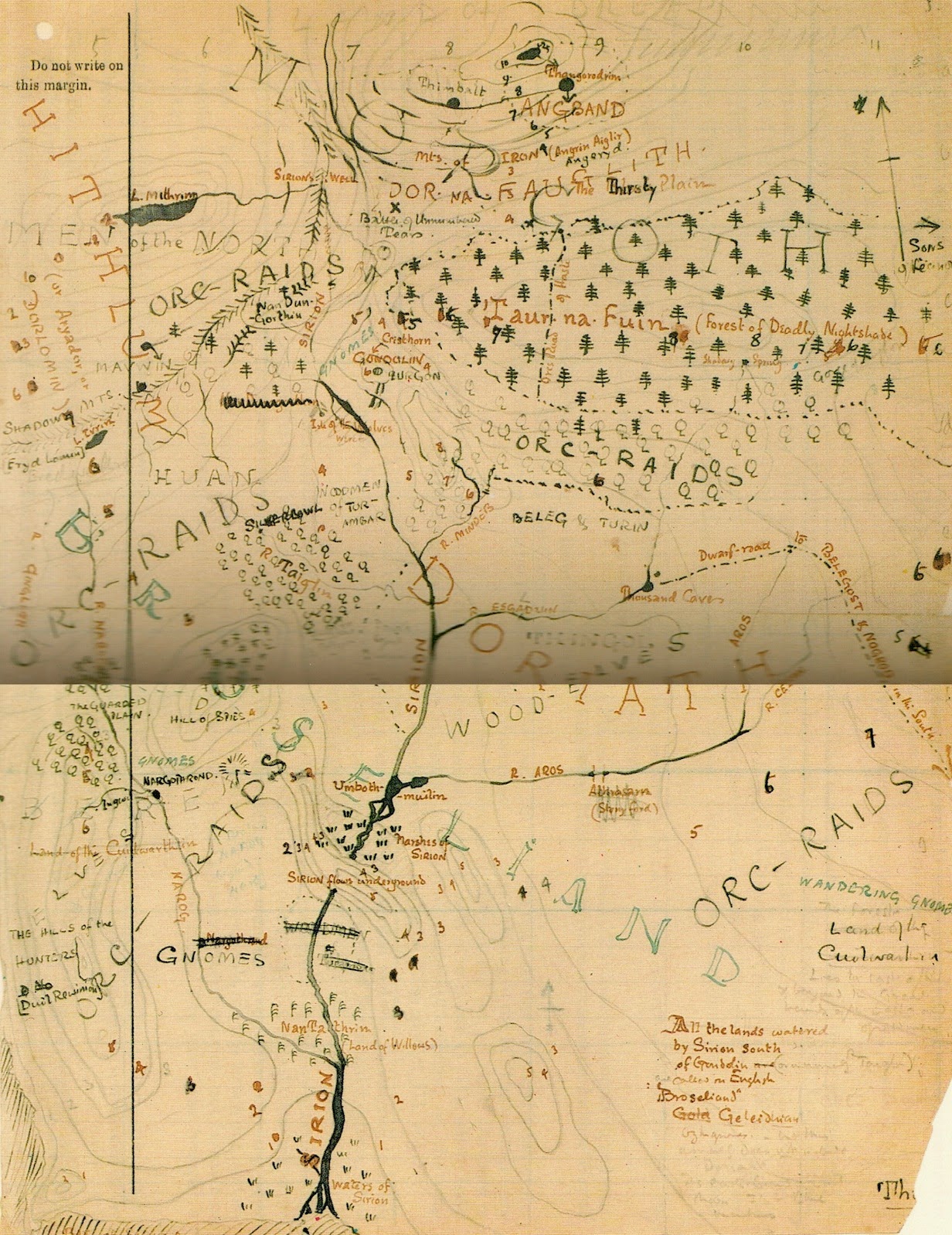
The richest of all wilderness maps, from HoME volume iv: Note the contour lines which give completely new information about altitude not contained in other Beleriand maps. I think I will include them on my version. Im also wondering about inking in 'Huan' & 'Orc Raids' & 'Fingolfin' and so on.  |
|
|
|
Post by kent on Apr 25, 2014 19:22:18 GMT -6
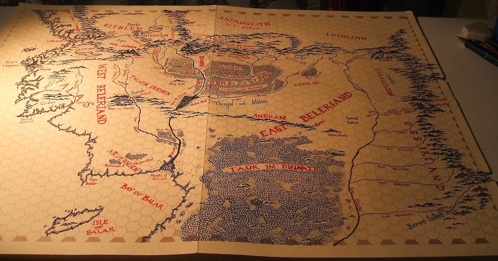
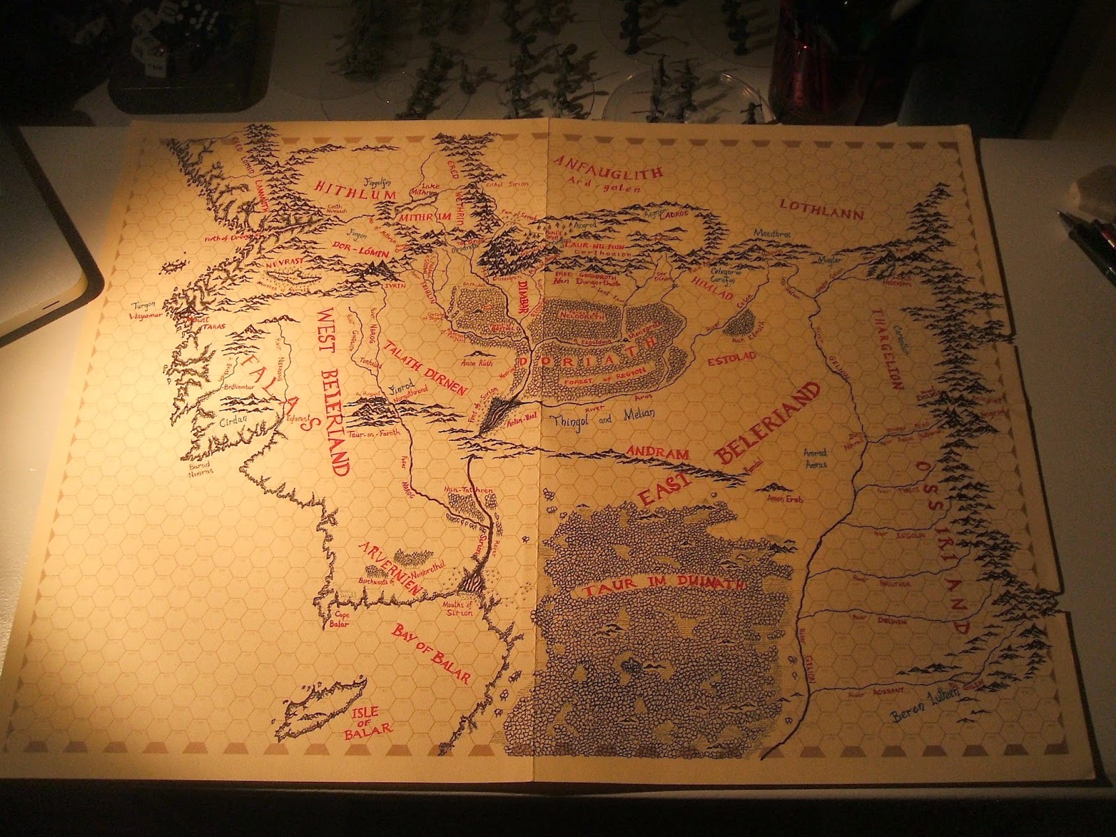
Finally finished this map. Next stop ... Mercury. Slightly larger images on blog.   |
|
Torreny
Level 4 Theurgist
  Is this thing on?
Posts: 171
|
Post by Torreny on Apr 26, 2014 3:27:22 GMT -6
Oh, this is glorious to behold. I shall enjoy seeing Mercury as well.
|
|
|
|
Post by kent on Apr 26, 2014 4:06:39 GMT -6
Ta. Mercury poses the problem that there is no map to work from but Eddison has made several simple maps of both real and imaginary lands so I do have a style to work with.
|
|
|
|
Post by Falconer on Apr 27, 2014 19:37:03 GMT -6
That’s beautiful, Kent.
|
|
|
|
Post by Falconer on Apr 27, 2014 19:37:38 GMT -6
Are you looking at anyone else’s Mercury maps, or starting from scratch?
|
|
|
|
Post by kent on Apr 28, 2014 2:49:15 GMT -6
I will have to wait a few months before I can slot in Ouroboros to read again, and when I do I will examine the decisions made by this artist below. Whoever it was (David Bedell 1978) his map is highly original and gorgeous. Properly his would be about the size of 3 JG sheets in one row. I might do the civilized nations on one sheet with Impland on another at a different scale. The style for the civilized nations would be that of the Icelandic sagas, maps which Eddison drew for himself, and Impland would be different. I might not use JG sheets at all and use paint and pens on a huge sheet. The technique is one thing; decisions about the topography and physical relationships of the lands another and new problem.  |
|